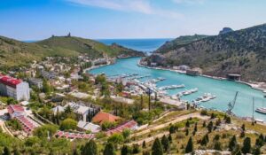
Any Ukrainian counteroffensive in Southern Ukraine shortens the distance to Russian military objects in Crimea for Ukrainian high precision strikes. It is high time to define their coordinates. Last time the Center for Journalist Investigations described Russian military objects in Chornomorske. Military radars at Tarkhankut Cape and Russian bases in Novoozerne village are very close.
We address a series of publications about Russian military objects in Crimea to civilian residents of Crimea and Sevastopol. As these objects are legitimate military targets for the Armed Forces of Ukraine, we advise civilians to avoid them, in order to secure their lives.
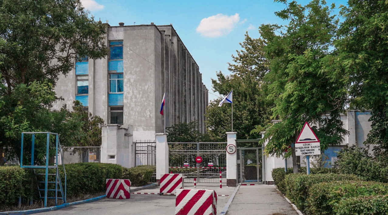
Checkpoint at the entrance to headquarters of Novoozerne basement raion of Russian Black Sea, August 2019. Photo: RFE/RL
Before Russian occupation, separate radiolocating company # 1476, aviation guidance point # 260 and separate radiolocating platoon # 160 of the Ukrainian Air Force were located at Tarkhankut Cape. They were part of the headquarters of separate radiotechnical Crimean brigade # 40 of the Ukrainian Air Force. After seizure of their premises and equipment in 2014, Russian occupants created on their basis the 3rd radiotechnical regiment of radio engineering troops of Airspace Forces of the Russian Federation.
Tarkhankut Cape also hosted one object of the Ukrainian Navy – radiotechnical platoon # 501 of the 21st raion of surveillance (military unit # A4249, Novoozerne village).
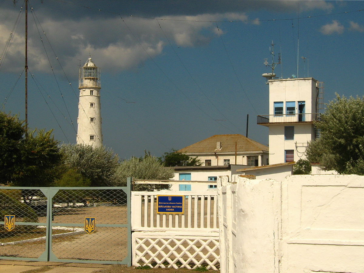
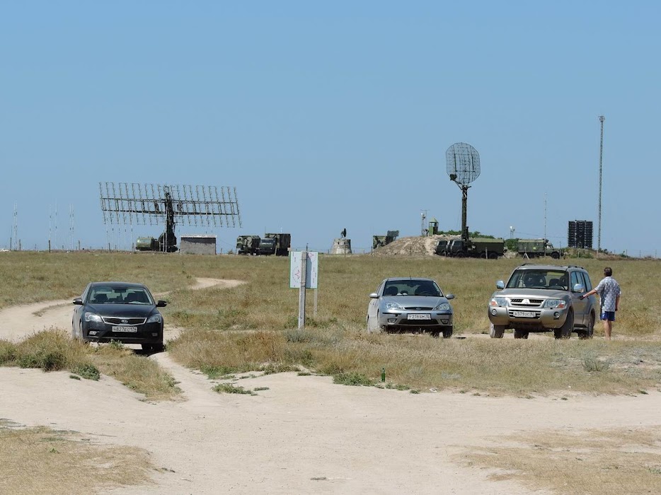
Entrance to military unit А4249, Tarkhankut, photo: Rost Deore / Google Earth
Now this place is occupied by Russian radiotechnical platoon \ military unit # 43536. This platoon encircles well-known Tarkhankut Lighthouse.
Russian occupants built an asphalt road from neighboring Olenivka to this military object in 2016-2019.
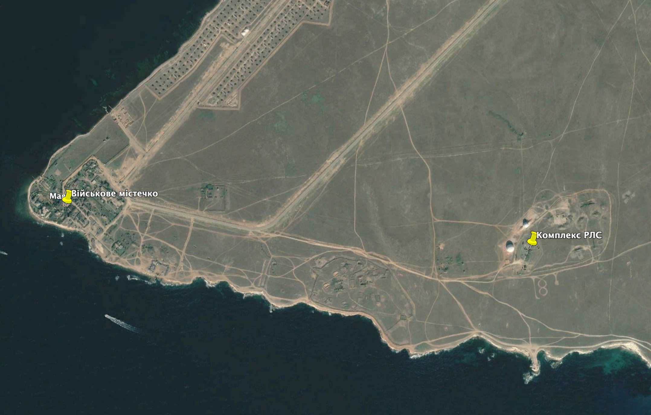
Photo: Google Earth
This combination of Russian Navy and Air Force radars are «eyes» of Russian occupants in north-western sector of Crimea and Black Sea. Cutting these «eyes» will weaken Russian troops, their Air Forces and air-defence systems.
It is evident that it is not difficult for the Armed Forces of Ukraine to determine exact location of their former military object (coordinates 45.347974, 32.497709) and to strike it with high precision rockets.
Russian surveillance radar systems «Nebo-M» and «Kasta-2E2». Tarkhankut. 2016. Photo: starcom68.livejournal.com
More important object is located two kilometers to the east from the Tarkhankut Lighthouse (coordinates 45.345563, 32.522394). It is Russian radiolocating hub. In 2016, the user of LiveJournal starcom68 photographed it and analyzed its equipment. Mobile surveillance radar «Nebo-M» (Russian pretend it can detect air and space objects within a radius of 400 km) and low level surveillance system «Kasta-2E2» were situated there.
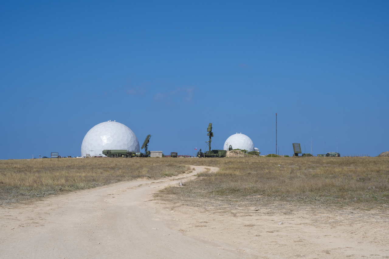
Radio transparent domes for radar systems. Tarkhankut. Photo: crushpixel.com
Since then situation changed. In accordance with 2019 and 2020 satellite images, two radio transparent domes were built there. It means stationary radar systems appeared near mobile radars. It makes this object even more attractive for Ukrainian high precision strikes.
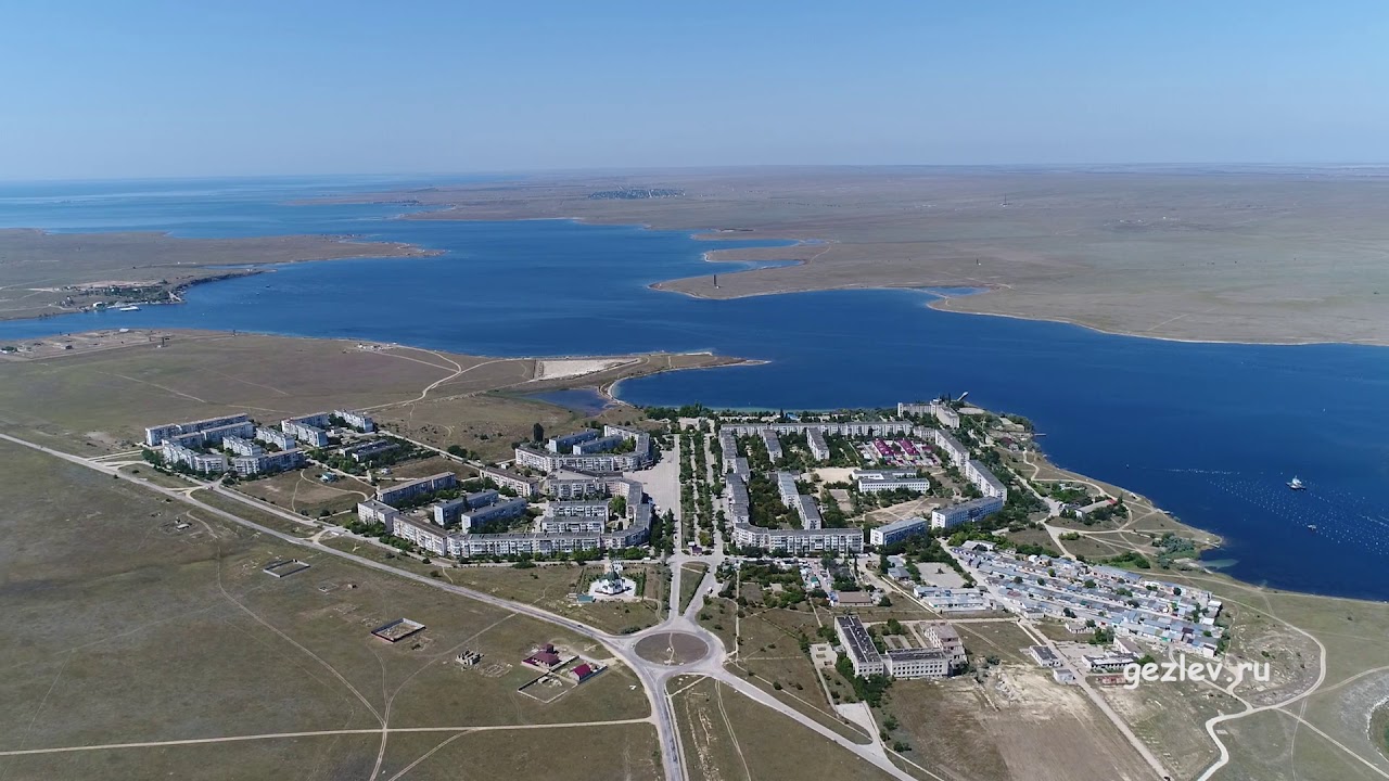
Donuzlav Lake, Novoozerne village. Photo: Gezlev.ru
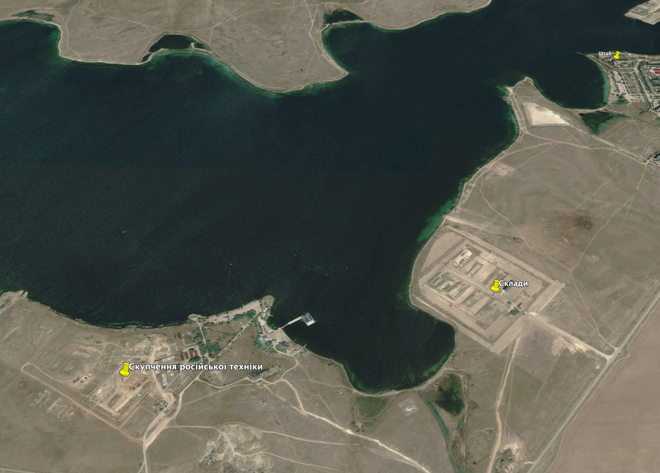
Let us look further along south-western Crimean shore – at Donuzlav Lake and the Southern base of the Ukrainian Nay seized by Russian occupants in 2014.
Headquarters of the Southern base of the Ukrainian Navy in Novoozerne village. Photo: Google Earth
Russian assault on the base and capitulation of its officers were video documented. It became one of the most known video illustrations of the Russian occupation of Crimea. It is also an evidence of the war crime of the Russian Federation as its troops used peaceful people as «human shield». The Center for Journalist Investigations mentioned those events in its material about one of organizers of the blockade and assault of the base – «Доля колаборанта. Юрій Жеребцов» (Fate of collaborator. Yuri Zherebtsov).
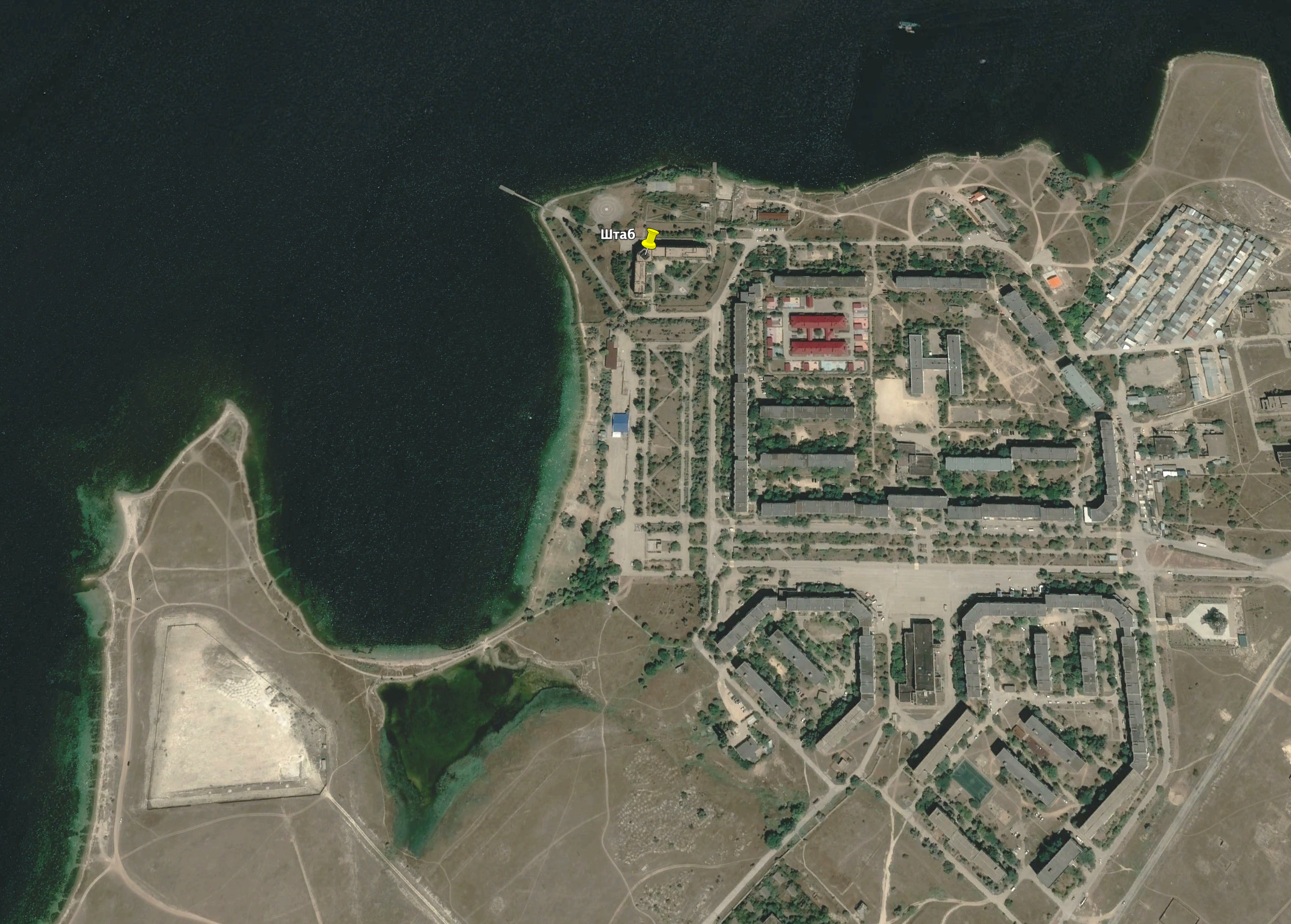
Today this base is occupied by headquarters of Novoozerne basement raion of the Russian Black Sea Fleet (coordinates 45.387112, 33.113859). Located in Novoozerne village, on Donuzlav shore, its building is easily recognizable by numerous antennas on the roof.
Building of the Headquarters of the Southern base of the Ukrainian Navy. Photo: salech hcelas / Google Earth
Russian military base is located within three kilometers to the east from headquarters (coordinates 45.400045, 33.147824). Published a few days before Russian full scale invasion, satellite images of the base became known across world media but it did not stop invasion.
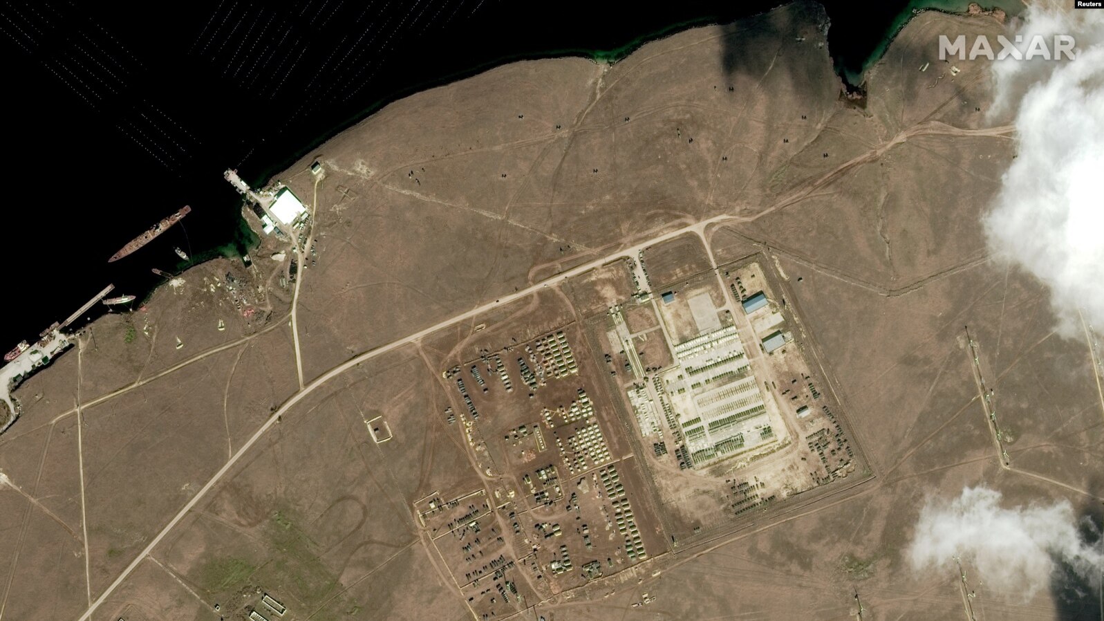
Storage base of the Armed Forces of the Russian Federation near Donuzlav Lake. Photo: Reuters / Maxar Technologies
It is unknown whether this base is full of Russian troops and weapons but Ukrainian intelligence can find out…
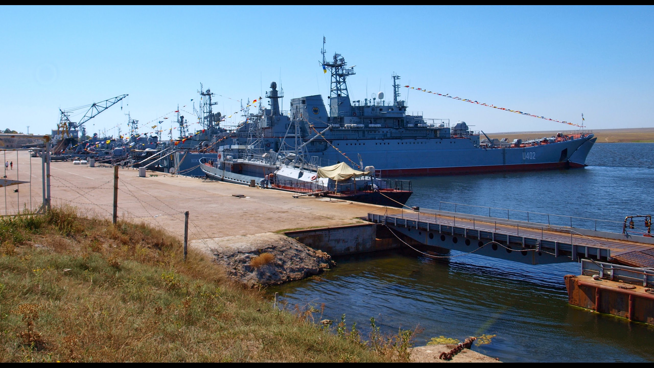
Ukrainian ships near mooring wall of the Southern base of the Ukrainian Navy. March 2014. Photo: Torpedolov Ukraine / Google Earth
The base is located near the mooring wall of the Southern base of the Ukrainian Navy (coordinates 45.400105, 33.133327), also seized by Russian occupants in 2014. After successful strikes of Ukrainian rockets, the majority of ships of the Russian Black Sea Fleet stay in Sevastopol but they also use Donuzlav Lake. For example, Russians planned to tow boats damaged by Ukrainian rockets at Snaky Island to Donuzlav Lake. After failed attempt to seize Odesa, Russian ships retreated to Donuzlav Lake.
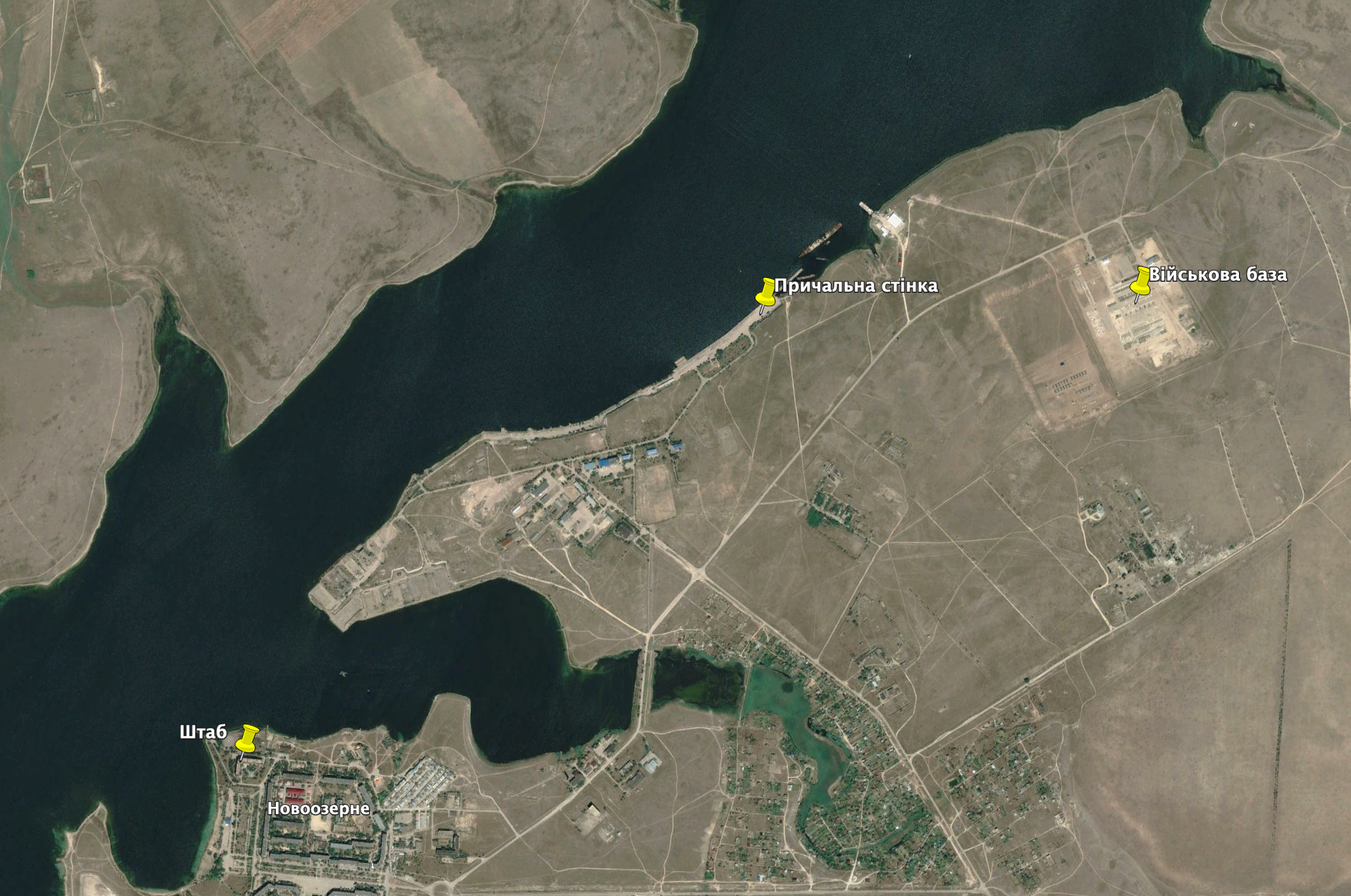
Storage base, Headquarters and mooring wall of the Southern base of the Ukrainian Navy. Photo: Google Earth
There are old military warehouses located on the other side of Novoozerne village (coordinates 45.373567, 33.103321). Satellite images show that Russian occupants renovate them.
Military warehouses and location of Russian military equipment. Photo: Google Earth
There is another place of storage of the Russian military equipment (coordinates 45.370763, 33.090747), identified by satellite before the Russian invasion.
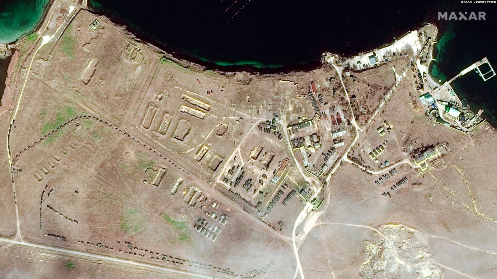
Russian military equipment near Donuzlav Lake. Photo: Reuters / Maxar Technologies
Old military airfield is located on the same shore of Donuzlav Lake (coordinates 45.333270, 33.046003). Russians put there dozens of military helicopters in February 2022.
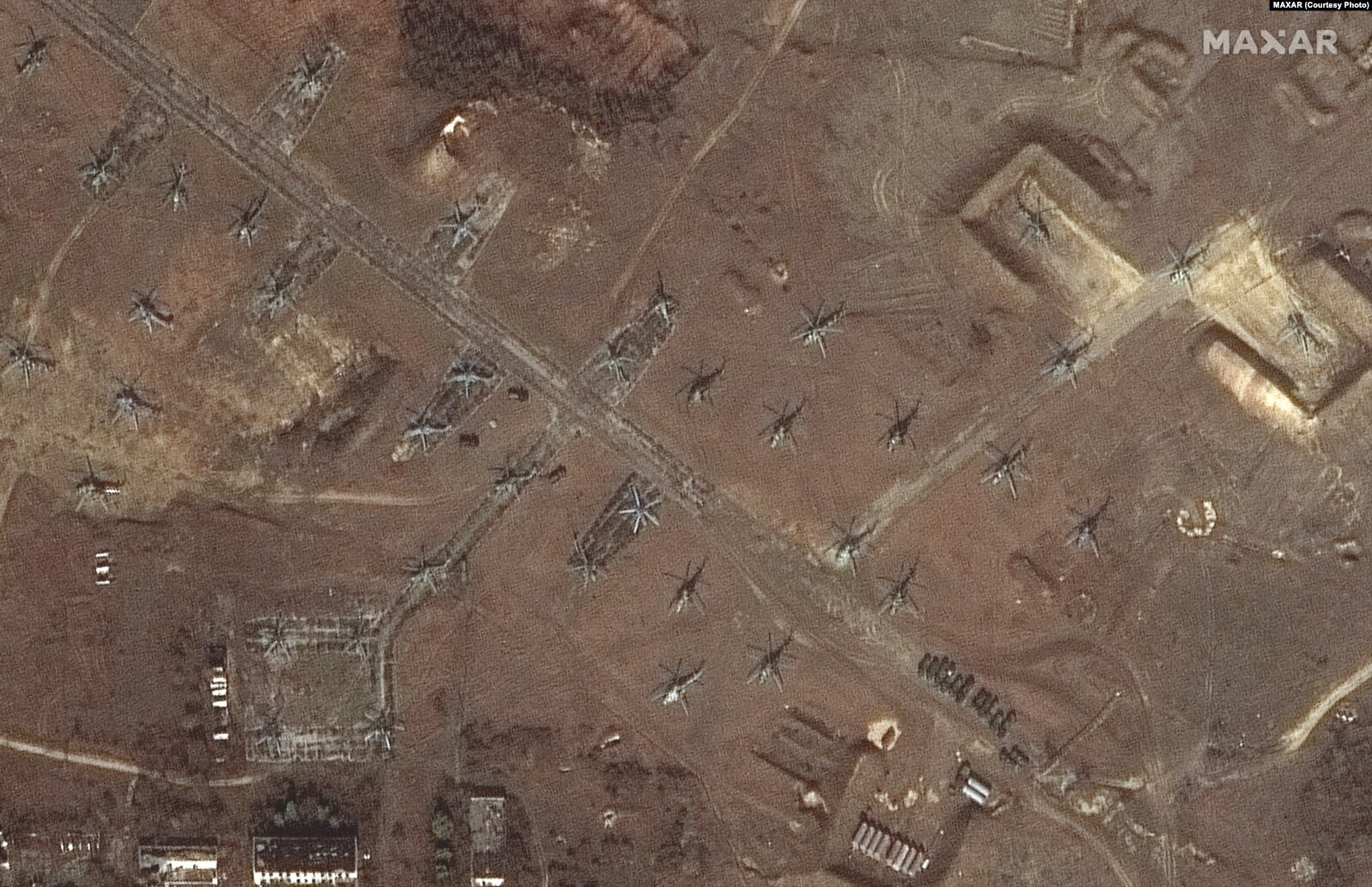
Russian helicopters on the airfield near Novoozerne. Photo: Maxar Technologies
The airfield displays open and protected parking lots for air planes, hangars etc.
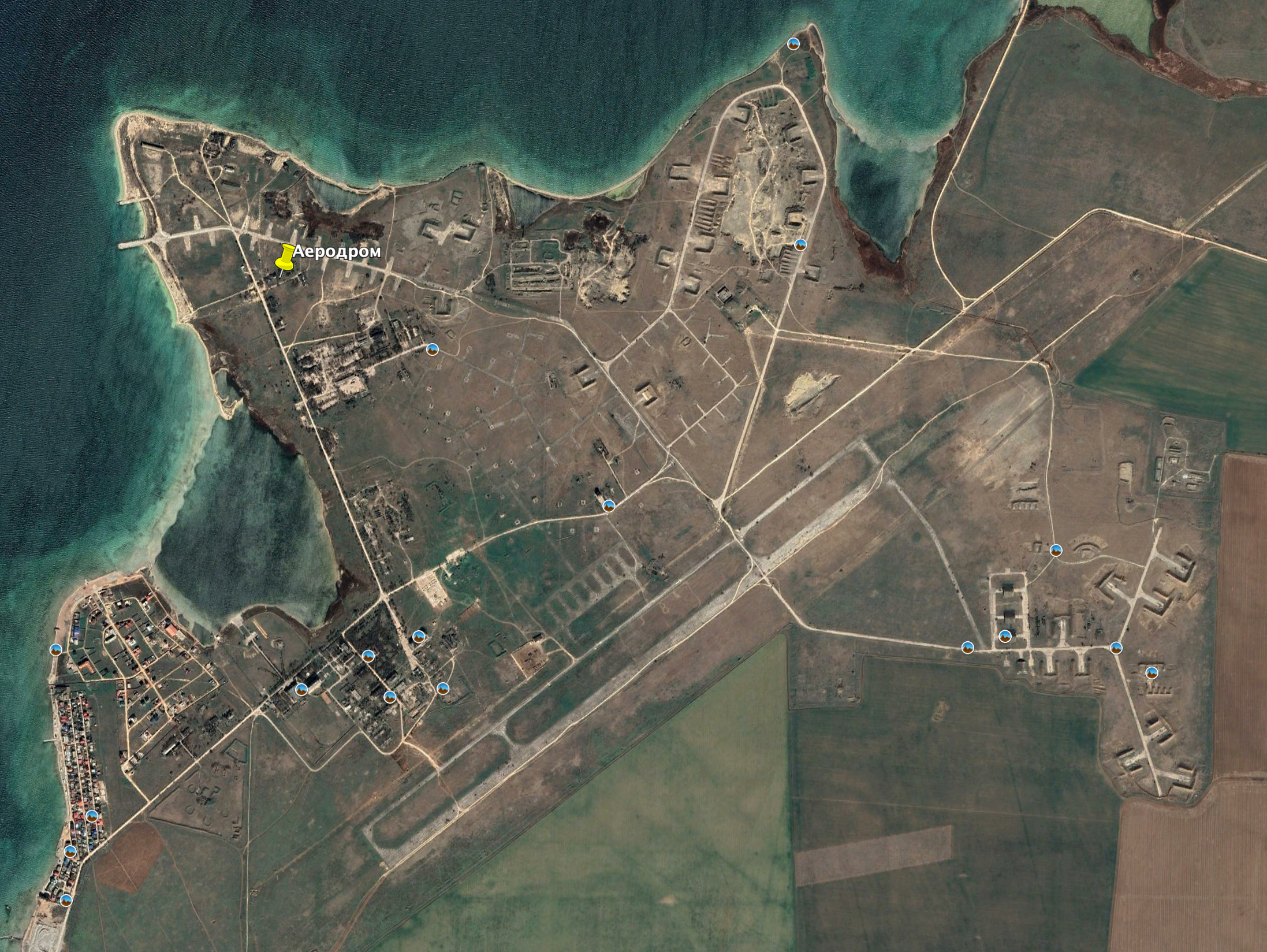
Airfield near Novoozerne village. Photo: Google Earth
The headquarters of Novoozerne basement raion of Black Sea Fleet and military base of Russian radiotechnical troops at Tarkhankut are all located within settlements. It is high time for residents of neighboring houses to think about safer places for living. The same is true for peaceful residents of Mayak village at Tarkhankut. Tourists who like places near the Tarkhankut Lighthouse should recall successful Ukrainian attack on Novofedorovka and understand that the Armed Forces of Ukraine will not wait until the end of the vacation time…
OSINT researcher Irakli Komakhidze published Full list of Russian military objects in Crimea with all legitimate military targets in Crimea for the Ukrainian Armed Forces. We will do our best to provide their detailed description.
Material is prepared by non-profit «Information press center» within IWPR project under the support of the European Union and the Royal Norwegian Ministry of Foreign Affairs.